
This is what we saw yesterday, officially:
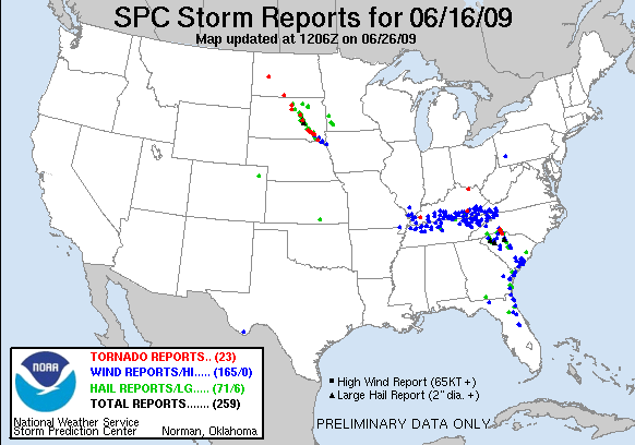 Each of those red dots represent a report of a tornado. You can see a good-sized line of tornado reports that went from NW to SE through the evening. Remember that in a tornado situation you need to try to plan ahead so when the sirens go off you won't be caught off-guard. We could be looking at more storms like this in the eastern half of South Dakota again and into Minnesota and Iowa and Nebraska as well...
Stay tuned to KDLT and definitely check out our KDLT Weather Blog later - and we'll update you as needed.
~KDLT Meteorologist Aaron Shaffer
No comments:
Post a Comment
Thoughts from you guys...