
Here is what the set-up is for tonight:
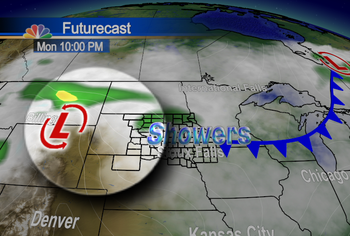 We highlighted the low pressure system centered just to the west of South Dakota. You can see we'll be seeing some light showers moving through - but the bulk of the rain takes a while to build in.
We step ahead to the next stage, with the bulk of the storm system and its associated rainfall highlighted:
 As of now, while we are looking for some lingering patches of rain during the day Tuesday, and again during the day on Wednesday, most of the rain for eastern South Dakota into SW Minnesota and NW Iowa will hold off until Tuesday evening into the overnight hours.
Stay tuned over the next 24 hours - and know that despite the fact that it is raining, at least we're avoiding snow for this one!
~KDLT Chief Meteorologist Aaron Shaffer
No comments:
Post a Comment
Thoughts from you guys...